
Humminbird Charts and Maps

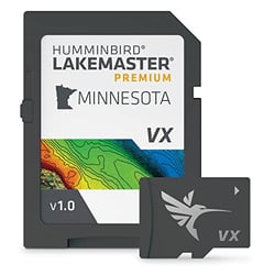
Humminbird 602006-1 LakeMaster Premium Minnesota V1 GPS Map Card with VX Technology
Humminbird Charts & Maps: Cartography Built for Anglers
When it comes to on-water navigation and fishing intelligence, Humminbird has set the standard for anglers who refuse to leave fish-finding to guesswork. Their lineup of charts and maps is not a generic add-on — it is a fully developed cartography ecosystem engineered from the ground up to work hand-in-glove with Humminbird fish finders. Whether you fish freshwater lakes, inland reservoirs, or coastal waters, Humminbird's mapping solutions deliver a level of detail and interactivity that paper charts and generic GPS maps simply cannot match.
LakeMaster: The Freshwater Standard
LakeMaster maps with VX Technology deliver an exact understanding of the bottom terrain, and powerful features to eliminate unproductive water, including SmartStrike technology, Depth Highlight, Shallow Water Highlight, and Water Level Offset. For anglers who want even more, LakeMaster Premium adds Aerial Imagery and 2D Shaded Relief layers on top of all standard LakeMaster features. These tools let you visualize structure, target productive depth ranges, and synchronize your chart to real-time water levels — all critical advantages when fish are holding tight to subtle transitions.
LakeMaster high-definition maps are created from on-the-water surveys using hundreds of thousands of depth soundings plus state-of-the-art GPS and sonar technologies, collected by Humminbird's own team of GIS analyst cartographers. That kind of firsthand data collection means the contour lines on your screen reflect what is actually on the bottom — not an approximation.
One of LakeMaster's most compelling integrations is its compatibility with Minn Kota trolling motors. Pair your Humminbird fish finder GPS combo and a compatible Minn Kota® trolling motor to control your motor right from your unit — and for hands-free fishing, your Minn Kota can automatically follow a depth contour on your LakeMaster chart.
AutoChart: Map Water Nobody Else Has Mapped
For anglers who regularly fish spots that even the best pre-made charts don't cover, Humminbird's AutoChart line is a game changer. AutoChart™ uses your Humminbird sonar returns and GPS to build customized charts. Included with AutoChart PC software is a 32 GB map card loaded with Zero Lines — shorelines for millions of water bodies in North America — so you can begin creating your own detailed maps of any fishing spot, even where contour coverage doesn't exist.
For real-time mapping, AutoChart® Live is a free feature available with all GPS-equipped XPLORE, APEX, SOLIX, and HELIX G2/G2N and newer models. AutoChart Live gives anglers the ability to map depth contours, aquatic vegetation, and changing bottom hardness — a "trifecta" of information critical to finding fish as they relate to depth, weed lines, and transition points in bottom type.
Tournament-level anglers can step up to AutoChart PRO. Bottom Hardness Indication delivers a crucial tip-off to where fish are hiding, while Side Imaging Mosaic allows you to overlay your Side Imaging returns onto your AutoChart map for a 3D visualization of fish-holding habitat.
CoastMaster: Precision for Saltwater Anglers
Humminbird® CoastMaster® charts provide incredible accuracy and detail for saltwater fishing, with easy-to-read contours and chart customization tools to identify the spots most likely to hold fish — and navigate there safely — built on the latest data available for unrivaled nearshore and offshore performance. Using predictive software, CoastMaster also allows you to plan your fishing day with tidal direction and height, as well as current speed and direction.
A Complete Cartography Ecosystem
Humminbird's built-in Basemap is based on freshwater data from LakeMaster and NOAA — the most-trusted saltwater source — providing a clear view of underwater terrain. And for anglers who want additional options, Humminbird fish finders are also Navionics® compatible for even more map options, no matter where or what you fish for. This breadth of cartography solutions, all designed to integrate seamlessly with Humminbird hardware, makes their charts and maps an essential part of any serious angler's setup.