



Maptech

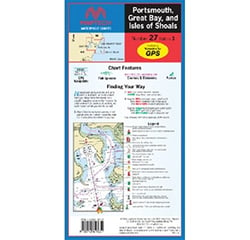
Maptech WPC027-03 Waterproof Chart 27 Portsmouth to Great Bay Islands & Shoals
Maptech: 50 Years of Trusted Marine Navigation
For boaters who take navigation seriously, Maptech has been an indispensable name on the water for over five decades. As the publisher of the renowned Maptech® ChartKits®, Richardsons' Chartbooks, Embassy Cruising Guides, and advanced marine navigation software, Maptech has built a reputation as one of the most comprehensive sources of nautical information available to recreational and serious cruisers alike.
Printed Nautical Charts & ChartKits
At the heart of Maptech's product lineup are its iconic ChartKits — full-color reproductions of official NOAA charts bundled together by large cruising regions. With over one million ChartKits sold, these spiral-bound chart collections cover everything from the coast of Maine and the Great Lakes to Florida, the Bahamas, Puerto Rico, and the Virgin Islands. Each edition includes GPS waypoints, pre-plotted courses and distances, aerial harbor photography, and navigational reference data — making them a trusted companion whether you're navigating familiar home waters or an unfamiliar offshore passage.
Complementing the ChartKits are Maptech's waterproof folding charts, printed on durable, tear-resistant paper and featuring pre-plotted waypoints and marine facility information. These standalone charts are built to withstand the harsh marine environment, delivering critical navigation data even when electronics fail.
Embassy Cruising Guides & Richardsons' Chartbooks
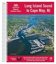
Beyond raw chart data, Maptech produces the celebrated Embassy Cruising Guides — comprehensive publications packed with local knowledge, harbor service listings, GPS waypoints, aerial photographs, and cruising advice for hundreds of destinations. Available in printed and digital formats, the Embassy Guides cover major East Coast regions including New England, Long Island Sound, Chesapeake Bay, the Intracoastal Waterway, and Florida to Mobile Bay. Boaters consistently cite these guides as indispensable planning tools that go far beyond what any internet source can offer.
Richardsons' Chartbooks round out Maptech's print lineup, offering spiral-bound coverage of popular cruising areas with detailed chartbook-style pages, cruising information, marine facility listings, and aerial harbor photographs — an ideal format for navigating at the helm.
Marine Navigation Software & Digital Charts
Maptech doesn't stop at print. Their digital software suite — including Chart Navigator Pro and Chart Navigator Basic — delivers full-featured GPS chart-plotting and route-planning capabilities for PC users. These software packages include over 2,200 NOAA nautical charts and insets, more than 750 inland river charts from the U.S. Army Corps of Engineers, and Maptech's proprietary Contour 3D Charts, tides and currents data, navigation photos, and coastal topo maps — all on a single USB flash drive. For iPad users, the Maptech iPlot app brings the same trusted chart data to a touchscreen interface, making underway navigation easy and accessible.
Why Boaters Trust Maptech
What sets Maptech apart is the depth and reliability of its navigational content. Whether you prefer the tactile confidence of a printed ChartKit on your chart table or the convenience of real-time GPS positioning on a laptop, Maptech offers a product that fits your workflow. Their interactive online facility guide also provides marine facility information and drone videos for select harbors and destinations, extending the value of their products into the digital realm. From coastal cruising to offshore passages, Maptech equips boaters with the information they need to cruise with confidence.