


Garmin Fishfinders/GPS/Chartplotters & Network Systems
Navigate Smarter, Fish Harder: Chartplotters, GPS & Network Systems
Whether you're threading a channel in fog, marking a honey hole on a freshwater lake, or running offshore in search of big game fish, the right marine electronics can be the difference between a great day on the water and a dangerous one. Fishfinders, GPS chartplotters, and network systems are the nerve center of any modern boat — combining precise positioning, underwater sonar imaging, and chart data into a single, actionable picture at the helm.
What Are Fishfinders, Chartplotters & Network Systems?
These three categories of marine electronics are often sold together because they work in concert. A fishfinder uses sonar technology to display underwater structure, depth, and fish locations in real time. Fishfinders range from simple single-frequency units to advanced systems featuring CHIRP sonar, ClearVü, and SideVü scanning — which deliver near-photographic detail of the water column and bottom contours.
A GPS chartplotter overlays your boat's precise GPS position onto navigational charts, letting you plot routes, set waypoints, and avoid hazards. Many modern units integrate both fishfinder sonar and charting functions into one multifunction display (MFD). Network systems take things further by linking multiple displays, radar units, autopilots, cameras, and sonar modules so all devices share data seamlessly across the helm — a critical capability for larger or more sophisticated vessels.
Key Considerations When Shopping
- Screen size and resolution: Displays range from compact 4" units for small skiffs to expansive 27" MFDs for center consoles and cruisers. Sunlight readability is essential for daytime use on the water.
- Sonar capabilities: Entry-level units offer traditional 2D sonar, while advanced models support CHIRP, DownScan, SideVü, and live-scanning sonar technologies for a far more detailed view beneath the hull.
- Chart compatibility: Most units come preloaded with coastal or inland charts. Look for compatibility with popular mapping platforms such as Navionics, C-MAP, and proprietary chart services to get the coverage you need.
- Network compatibility: If you plan to add radar, autopilot, VHF radio, or additional displays, choose a unit that supports industry-standard NMEA 2000 or a manufacturer's proprietary networking protocol.
- Connectivity: Wi-Fi and Bluetooth enable wireless chart updates, mobile app integration, and remote control from a tablet or smartphone — features that add real convenience for extended cruising or fishing trips.
Top Brands in Fishfinders, GPS & Chartplotters
Garmin is one of the most recognized names in marine electronics, offering a full lineup that spans from entry-level fishfinders to sophisticated multifunction networked systems. Garmin's chartplotters combine high-resolution displays, fast GPS positioning, and powerful processing to give captains a clear picture of where they are and what lies ahead. The brand's GPSMAP, ECHOMAP, and STRIKER product families cover virtually every boating use case, from casual freshwater anglers to serious offshore captains. With any of the GPSMAP series chartplotters, you can build a complete onboard marine system using NMEA networks or the Garmin Marine Network, connecting compatible sonar, autopilot, radars, cameras, and more.
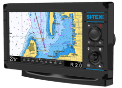
Si-Tex is a veteran in the marine electronics industry with a reputation for rugged, reliable performance. Established nearly forty years ago and headquartered in New York, Si-Tex Marine Electronics is a trusted source for electronic systems relied upon by mariners and watermen around the world. Si-Tex chartplotters and combo fishfinder units are known for their practical feature sets and versatility, with models designed to fit vessels ranging from small center-console skiffs to light commercial boats, supporting NMEA connectivity and popular chart formats.