


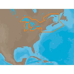
Electronic Charts


 Representative Photo, actual item may vary
 Representative Photo, actual item may vary

 Representative Photo, actual item may vary
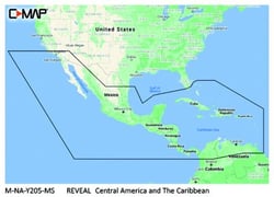
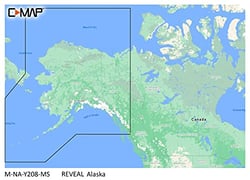
Lowrance M-NA-Y210-MS C-MAP Reveal Chart Hawaii Marshall Islands French Polynesia
 Representative Photo, actual item may vary
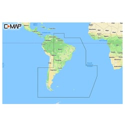


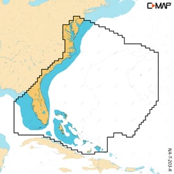
Navionics 010C136530 Navionics+ Digital Marine Chart Chile Argentina Easter Island
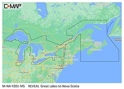
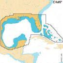
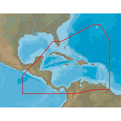
C-Map M-NA-Y210-MS REVEAL Coastal Chart Hawaii Marshall Islands French Polynesia
- 1
- 2
Navigate with Confidence: Marine Electronic Charts
Whether you're threading a channel at dawn, anchoring in an unfamiliar cove, or hunting structure on a bass lake, an accurate electronic chart is one of the most important tools aboard any vessel. Unlike traditional paper charts, digital marine charts display your GPS position in real time directly on your chartplotter, giving you a live, continuously updated picture of the water around you — from bottom contours and depth shading to marina layouts, tide information, and navigational hazards.
What Electronic Charts Do and Why They Matter
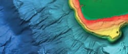
Electronic charts come in several forms: pre-loaded microSD/SD cards you plug into a compatible chartplotter, downloadable files, and app-based subscriptions. The core data they deliver includes coastal and inland waterway mapping, bathymetric (depth) contours, hazard markers, port and marina details, and increasingly, crowdsourced community data. For anglers, HD bathymetry revealing underwater structure — drop-offs, humps, ledges, and flats — can be the difference between a productive day and a blank. For cruisers and sailors, precise hazard mapping and dock-to-dock routing are safety essentials. Choosing the right chart depends on your region, your chartplotter brand, and whether you need offshore bluewater coverage, coastal detail, or freshwater lake maps.
Key Considerations When Shopping Electronic Charts
- Chartplotter Compatibility: Always verify the chart format (microSD, SD, or download) matches your specific chartplotter model before purchasing.
- Coverage Area: Regional charts focus on specific coastlines or lake systems; large-scale charts cover entire coastlines or multiple regions at once.
- Update Frequency: Many chart subscriptions offer daily or annual updates to reflect changing conditions, new surveys, and channel corrections.
- Fishing vs. Cruising Features: Anglers benefit from HD bathymetry and depth-shading tools, while cruisers prioritize routing, hazard alerts, and marina databases.
- Crowdsourced Data: Some platforms integrate user-contributed waypoints and local knowledge for richer, real-world accuracy.
Top Electronic Chart Brands
Navionics is widely regarded as one of the world's leading names in marine cartography. Navionics+ cartography provides integrated offshore and inland marine mapping content with rivers, bays, and more than 42,000 lakes around the world, while the Platinum+ tier adds relief shading, satellite imagery, and SonarChart™ Live — a feature that lets boaters build personal 1-foot HD bathymetric charts in real time while underway. Daily chart updates and dock-to-dock route guidance round out a package trusted by cruisers and anglers alike.
Garmin brings its hallmark GPS engineering to marine cartography, offering a massive catalog of electronic charts spanning freshwater lakes, coastal waters, and open-ocean regions. Garmin charts integrate seamlessly with their extensive lineup of chartplotters and multifunction displays, making them a natural pairing for boaters already in the Garmin ecosystem.
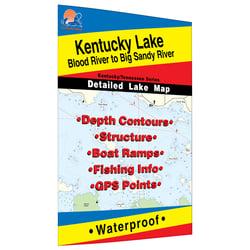
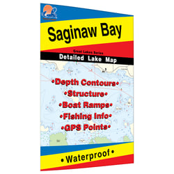
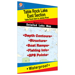
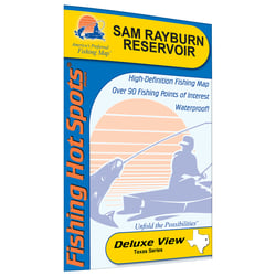
For anglers focused specifically on freshwater fishing, Fishing Hot Spots has earned a loyal following for decades. Each Fishing Hot Spots map is thoroughly researched and digitally produced with GIS tools, providing depth contours, structure, boat ramps, numbered fishing areas with detailed descriptions, and GPS waypoints — all the intelligence a serious angler needs to get on fish faster.
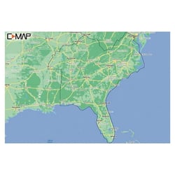
C-Map builds its navigation charts around precision, clarity, and quality, loading each chart with data from multiple sources that are frequently updated and expert-verified. Their Discover and Reveal chart families cover lakes, coasts, and oceans worldwide, and are compatible with Simrad, Lowrance, B&G, and other major chartplotter brands.
Lowrance offers electronic charts optimized for use with their popular fishfinder and chartplotter units. Lowrance chart cards deliver reliable inland and coastal coverage with the depth detail and structural data that freshwater and nearshore anglers depend on.